|
|
|
| Product Information: | ||
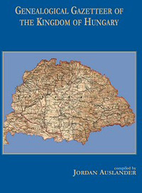
| Details: | Genealogical Gazetteer of the Kingdom of Hungary, compiled by Jordan Auslander, 8.5x11; 532 pp; softcover. Information about more than 12,000 towns within the 19th century borders of the Kingdom of Hungary that today comprise regions of Austria, Croatia, Hungary, Romania, Serbia, Slovenia, Slovak Republic and Ukraine. For each community, information is provided for the population by religion. If there was no local church or synagogue, the town where each congregation worshiped is indicated. This is key to identifying the Roman Catholic diocese, the church of record for the events of all faiths prior to civil registration in the 1850s. It is also useful in searching possible places of burial. Additional information about each town includes alternate names and its current name if no longer in Hungary. Towns can be searched alphabetically by their current name, former name or alternate name(s) Like so much of Europe, the Hungarian political and geographical boundaries have shifted over the centuries. In 1877 Janos Dvorzsak published a Hungarian locality dictionary, similar to a Gazetteer. The work included the 63 counties of the Kingdom of Hungary with a political and religious classification of the population in each. Genealogical Gazetteer of the Kingdom of Hungary, compiled by Jordan Auslander, was created to outline and compare the 1877 publication with Hungary today. 73 percent of the 1877 entries are no longer part of Hungary and have different names, belonging to different countries. This work is to help genealogists identify the different locations and recognize them for their prior names, ethnic and religious associations. Auslander provides a short history, including a chronology, to Hungary. The background includes an 1877 Population of Hungary by Religion table. The table is broken down by county, showing total population along with the religious breakdowns, including:
A map shows the boundaries of Hungary in 1877 and the areas lost to Austria, Czechoslovakia, Yugoslavia, and Romania in 1920. The book has over 500 pages with three columns per page, but was printed on a full 8.5″ x 11″ at a readable font size. The entire book is in alphabetical order for each location. Each entry includes the town name (as it appeared in 1877), the county or district, any alternate names, the current name and country, and the population by religion.
|
|

